Hurricane Charley: How Such a Small Core Produced Category 4 Winds
The strongest part of this Category 4 hurricane was surprisingly small.
When people picture a major hurricane, they often imagine an enormous storm delivering roughly the same conditions everywhere beneath it.
Hurricane Charley is a powerful example of why that picture can be misleading.
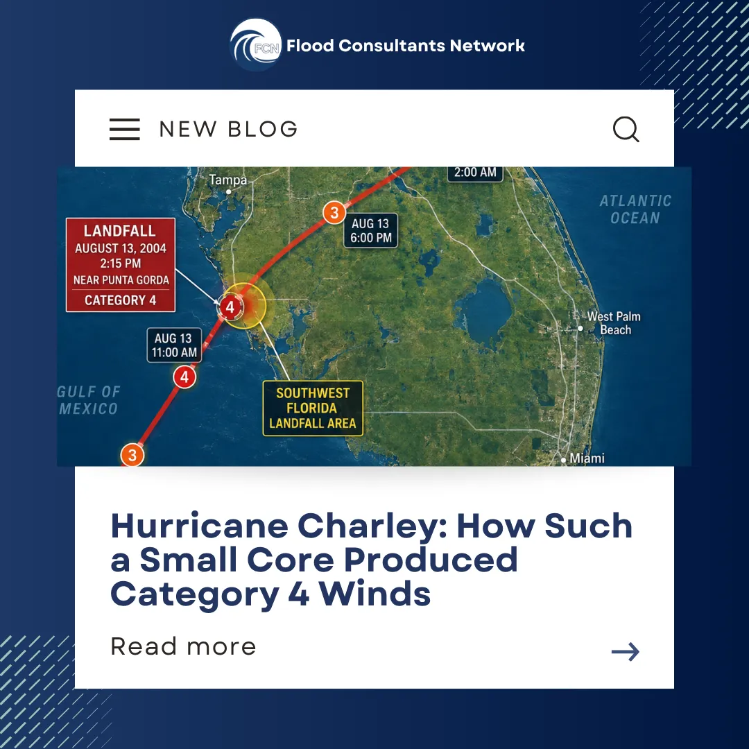
On August 13, 2004, Charley rapidly intensified as it approached Florida’s southwest coast. It reached Category 4 strength and made landfall near Cayo Costa with maximum sustained winds near 150 mph before its eye moved across the Punta Gorda and Port Charlotte area.
But one of the most remarkable details was the size of the hurricane’s inner core.
A Category 4 Hurricane With an Extremely Small Core
In the hours leading up to landfall, Charley’s eye shrank considerably.
The National Hurricane Center reported shortly after landfall that the closed eyewall had contracted to only about five miles in diameter. NOAA’s post-storm analysis found that Charley’s most extreme winds were concentrated within roughly six nautical miles of the center.
That is an important detail because a hurricane’s category tells us about its maximum sustained wind speed. It does not mean those maximum winds extend uniformly across the entire storm.
Charley combined tremendous intensity with a remarkably compact area of its most violent winds.
Why Location Mattered So Much
Think about what happens when a narrow path of exceptionally destructive winds crosses a populated area.
A relatively small change in the hurricane’s track can produce a major change in what a particular neighborhood experiences.
One community may encounter the eyewall and some of the hurricane’s strongest winds, while another community farther away from the center experiences substantially different conditions.
That is exactly why looking at the category number alone never tells the entire story.
Charley was moving north-northeast at around 20 mph as it approached southwest Florida. Its eye crossed the coast near Cayo Costa before passing over Punta Gorda and neighboring Port Charlotte. The storm then continued rapidly across the Florida peninsula.
A Hurricane Isn't One Giant Circle of Equal Force
Weather maps are useful, but they can unintentionally create a simple mental picture: a large circle representing the storm.
The conditions inside that circle can actually vary tremendously.
Several characteristics help determine what happens at a specific property or community, including the storm's:
exact track
size and structure
wind field
rainfall
storm surge
forward speed
interaction with local geography
Charley demonstrates this particularly well because its inner core was so compact.
While its maximum winds were extraordinarily powerful, NOAA noted that those extreme winds were confined to a very small area close to the center.
Charley Also Intensified Remarkably Fast
Its compact size wasn't the only notable feature.
As Charley accelerated toward southwest Florida, it underwent rapid intensification. NOAA's historical account reports that its central pressure dropped from 964 millibars to 941 millibars in just 4.5 hours. Its maximum winds increased from about 125 mph to 145 mph in approximately three hours, bringing Charley to Category 4 strength shortly before landfall.
That combination—rapid strengthening, a small eye and a fast-moving hurricane—made Charley an especially striking storm.
The National Weather Service's post-storm assessment also reported a maximum storm surge of approximately six to seven feet on Sanibel and Estero Islands.
What Hurricane Charley Can Still Teach Property Owners
More than two decades later, Charley offers a useful lesson that extends beyond hurricane history:
What happened at a particular property cannot always be understood from the storm's category alone.
Two properties relatively close to one another can experience different combinations of wind, water and structural damage depending on exactly how the storm moves through the area.
The same principle applies when reviewing damage afterward. The conditions experienced at the property—and the resulting scope of damage—matter more than simply knowing that a major hurricane passed through the region.
That is one reason detailed documentation after a flood or storm can be so valuable.
Photographs, contractor estimates, insurance estimates, repair records and other documents can help create a clearer picture of what happened and what was required to restore the property.
Still Have Questions About a Current or Previous Flood Claim?
If you've experienced flooding and still have questions about how your claim was evaluated, Flood Consultants Network (FCN) offers a Free Flood Claim Review.
The free review is an initial look at relevant claim documents, such as the insurance estimate and contractor estimate, to help determine whether the claim may warrant a closer review.
A claim doesn't necessarily have to be recent for you to ask questions.
Contact Flood Consultants Network to learn whether your current or previous flood claim may qualify for a Free Flood Claim Review.
Historical storm information in this article is based on reports and records from NOAA, the National Hurricane Center and the National Weather Service.